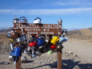
Once upon a time, I used to make my living making maps. Not making maps, really, using existing maps to collect data to build better maps. We collected data on the plant communities across national parks, to build vegetation maps that can be used to protect endangered plants, preserve critical habitat for animals, study the effects of climate change, and basically provide a baseline for any kind of ecological research that might be done in the park. I’ve worked on these projects at Denali, Lake Mead, Death Valley, and Mojave National Preserve. The process, at all of them, is pretty similar, although the temperature, scenery, and flora certainly varied. Here’s the story of how my crew mapped the plants across Death Valley National Park.
How to build a map
3

